


| lavi |

Perfect - I want to start a Golarion game in January, and this will help tell the players everything they need to know before I can get my hands on a World Guide this February... :)
| Sean K Reynolds Contributor |
Thanks Mr Reynolds :) - the new traits make me excited, but I hope that there's enough space to actually squeeze in new information about the many regions.
Again, this isn't the place to introduce *new* setting information on these regions, that's what the new campaign setting hardback is for (all countries get 4 pages). 20 pages in the main section of the Inner Sea Primer means each country is getting a column; it's a short summary of the country, not a place to insert new tidbits--unless it's something really big, in which case it would appear in the campaign setting, too.
For example, if the new campaign setting said that Queen Abrogail has been assassinated (she hasn't) and the new ruler is a lost twin brother of hers (also not true), and he's a paladin of Iomedae and the whole country has switched to worshiping Iomedae (they aren't), the Inner Sea Primer would say "thought until recently a country ruled by a noble house in league with Hell, they've all become happy crusaders for goodness."
But it wouldn't make sense to introduce new setting info in the Primer and not have it in the new campaign setting.
 GeraintElberion
|

Excited about this, will be my first book in my campaign setting subscription!
Bless,
I'm sorry to be the bearer of bad news but it won't.
This is part of the companion line (for players). You will be getting Misfit Monsters Redeemed from your sub.
As a superscriber I can only recommend that you sign up for the companion line as well, and the modules, and the tales, and the APS...
To be honest the sub. is may be more of a taster for this. If it's as good/essential as it might be I'll need five.
| Hobbun |

Ah yes, of course. I was thinking of the Map Folio for the Inner Sea, which comes out in November. You are right my first one in my Campaign Subscription is Misfit Monsters. :)
And yes, I have certainly thought about doing the Companion line as well, will most likely do so. But most likely not the rest you named. I am playing, not DMing, so no use for the AP's. What are Tales and APS?
|
|
And yes, I have certainly thought about doing the Companion line as well, will most likely do so. But most likely not the rest you named. I am playing, not DMing, so no use for the AP's. What are Tales and APS?
Pathfinder Tales is the fiction line, and he was using "APS" to refer to the Adventure Path line.
|
GeraintElberion
|
Ah yes, of course. I was thinking of the Map Folio for the Inner Sea, which comes out in November. You are right my first one in my Campaign Subscription is Misfit Monsters. :)
And yes, I have certainly thought about doing the Companion line as well, will most likely do so. But most likely not the rest you named. I am playing, not DMing, so no use for the AP's. What are Tales and APS?
That's cool.
Yep, like Vic said, I meant to write APs (for Adventure Paths), rather than APS. Sorry for the confusion.
| Hobbun |
Oh, not a problem. I think I was so used to see Adventure Paths abbreviated as AP, I thought maybe the abbreviation referred to something else.
And as you can see, I ended up getting the subscription for the Companion line. lol
| Elorebaen |

Welcome aboard Hobbun!
I just had a double-take, I thought this was also delayed like the main book, but it looks like it isn't! Yea!
| Hobbun |
Thanks!
On a slightly different note, for those who attended GenCon, didn’t Erik say something along the lines of a “Goblins of Golarion” coming down the road? I could have sworn he said something about it in one of the seminars.
| Justin Franklin |

Thanks!
On a slightly different note, for those who attended GenCon, didn’t Erik say something along the lines of a “Goblins of Golarion” coming down the road? I could have sworn he said something about it in one of the seminars.
Yep Goblins of Golarion is coming in the Player's Companion for GenCon next year.
| Hobbun |
Awesome!
Not really complaining, I just wish Paizo would have switched the release dates of Goblins and Orcs of Golarion, because we are doing a monster campaign and I am playing a Hobgoblin.
Maybe my DM will let me switch out my bloodline for the Goblin bloodline. At least I assume there will be one in the goblins book as there was for orcs.
|
|
The product image and description has been updated to match the finished product.
| Heaven's Agent |

The product image and description has been updated to match the finished product.
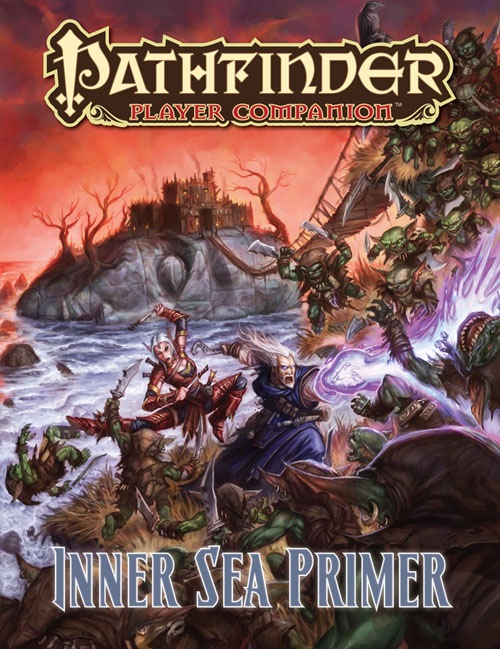
That cover certainly brings back good memories.
 Dark_Mistress
|

The product image and description has been updated to match the finished product.
Very cool.
| Jam412 |

Vic Wertz wrote:The product image and description has been updated to match the finished product.That cover certainly brings back good memories.
I was about to type the exact same thing, word for word before I saw your post. Great minds.. :-)
| Hobbun |
Sorry, nosey, but what memories are you two referring to?
And the cover looks great, look forward to the book coming in the mail!
| Sniggevert |

Sorry, nosey, but what memories are you two referring to?
And the cover looks great, look forward to the book coming in the mail!
RotRL spoiler
| Jam412 |
Sorry, nosey, but what memories are you two referring to?
And the cover looks great, look forward to the book coming in the mail!
That would be a RotRL AP spoiler. Not really a big one but just to be safe...
| Hobbun |
Oh, ok. Probably an AP I will never play, due to the price, and for the fact I don't see my DM using APs.
Thanks. :)
|
|

Is the archetype for the Aldori Swordlords going to be for fighter or rogue? I ask because I'm about to start running Kingmaker.
It's a fighter archetype.
|
Kvantum
|

Troubled_child wrote:Is the archetype for the Aldori Swordlords going to be for fighter or rogue? I ask because I'm about to start running Kingmaker.It's a fighter archetype.
Any clues as to how it's different than just running a Weapon Master archetype Fighter using an Aldori Dueling Sword?
| Sean K Reynolds Contributor |
Rob developed that section, but I'm pretty sure it allows you to do some tricks that you couldn't do with a standard fighter or weapon master (i.e., it's easy to customize the archetype's abilities if you know exactly what weapon they're using, rather than generic benefits for an unknown weapon).
| MerrikCale |

The product image and description has been updated to match the finished product.
most excellent
| KnightErrantJR |

The product image and description has been updated to match the finished product.
I loved that I immediately recognized that location.
 Gorbacz
|

Question: when are you guys expecting to ship it ? Please tell me it's going to happen this or next week ...
|
|
+1 with those hopes...
We share your hopes.
I hope you also share your hopes with the twin gods of trucking and customs.
| Liz Courts Contributor |

I hope you also share your hopes with the twin gods of trucking and customs.
They are fickle deities. Should I prepare a sacrifice?
|
Asgetrion
|

Vic Wertz wrote:I hope you also share your hopes with the twin gods of trucking and customs.They are fickle deities. Should I prepare a sacrifice?
Sacrifice always works... may I boldly suggest sacrificing the extensive collection of ladies' underwear Wes owns? Some of those glittery and gauzy things must be worth a fortune...
| bugleyman |

Sacrifice always works... may I boldly suggest sacrificing the extensive collection of ladies' underwear Wes owns? Some of those glittery and gauzy things must be worth a fortune...
Unfortunately, the items in question are no longer in new condition, greatly reducing their resale value...
| Black Dow |

Asgetrion wrote:Sacrifice always works... may I boldly suggest sacrificing the extensive collection of ladies' underwear Wes owns? Some of those glittery and gauzy things must be worth a fortune...Unfortunately, the items in question are no longer in new condition, greatly reducing their resale value...
It matters not - sheer numbers of these trinkets and the blood, sweat and tears endured to procure them will appease the gods!
Prepare the offering!!
| Hyla Arborea |

Just took a quick look at my .pdf of the book. First thought: I don't like the new map at all. Its all candy-coloured! And the new northern border does not show any more detail of the lands in the north as was hinted at. Its just greenish instead of white and sports a conveniently straight east-to west mountain range. Also: No scale bar.
| bugleyman |
Just took a quick look at my .pdf of the book. First thought: I don't like the new map at all. Its all candy-coloured! And the new northern border does not show any more detail of the lands in the north as was hinted at. Its just greenish instead of white and sports a conveniently straight east-to west mountain range. Also: No scale bar.
My hard-copy is inbound, but as a non-subscriber, I lack early PDF access. :( I'll be picking up the PDF ASAP, though.
One question: Is the map separate, like the old Gazetteer? If not, does anyone know if major changes have been made?
| Hyla Arborea |
One question: Is the map separate, like the old Gazetteer? If not, does anyone know if major changes have been made?
Judging from the .pdf the map is not separate, but on the inside of the front cover.
| bugleyman |
bugleyman wrote:Judging from the .pdf the map is not separate, but on the inside of the front cover.
One question: Is the map separate, like the old Gazetteer? If not, does anyone know if major changes have been made?
KHHHAAAANNNN!!!! :P
Can any Paizo folks chime in on the viability of continuing to use the Gaz map in conjunction with the Player's Guide?
Thanks!
| Black Dow |
Mmmm interesting - I'm a Companion Subscriber but no early pdf love as yet? Are the wheels turning or have I missed out somehow???
| Sean K Reynolds Contributor |
Can any Paizo folks chime in on the viability of continuing to use the Gaz map in conjunction with the Player's Guide?
Both maps are essentially the same...?
| Justin Franklin |
Hyla Arborea wrote:bugleyman wrote:Judging from the .pdf the map is not separate, but on the inside of the front cover.
One question: Is the map separate, like the old Gazetteer? If not, does anyone know if major changes have been made?KHHHAAAANNNN!!!! :P
Can any Paizo folks chime in on the viability of continuing to use the Gaz map in conjunction with the Player's Guide?
Thanks!
The only major change I can see is there are fewer cities on the map (mostly just the capitals) and the ice shelf has receded in the north a bit.
|
|
The maps are indeed essentially the same. The map on the inside cover of the Inner Sea Primer intentionally does NOT have lots of tags; it only lists the names of the nations and the capital cities. Putting all of those tags on the map would have made it way too cluttered.
This IS the version of the map that'll be printed in the upcoming "World Guide: The Inner Sea" as well as the same map that will be in the Inner Sea Map Folio... although those versions will be much larger (the poster map in the World Guide will be 8 times as big, while the one in the Map Folio will be 32 times as big), and as such will have PLENTY of room to put all of the smaller tags on.
Now, as for the business at the upper edge of the map... that's a tiny bit of an error; the map image should have been cropped a lot closer to the top edge of the map, so that the mountains and all that run right up along the upper edge. What's beyond that point is "unknown," but it's certainly NOT just a strip of green featureless land.
As for "candy colored," is that mostly as a result of the dotted red lines that show the national boundaries? If so, those borders are probably not going to be appearing on the poster maps themselves.
And as for a scale bar, yeah, it's unfortunate that got left off of the map, but at the same point the map isn't intended to be the GM's go-to resource for measuring distances. THAT map is the one in the upcoming World Guide, or the map folio, both of which WILL have scale bars. The map in the Inner Sea Primer has basically ONE job—to show players the shape of the world and where all the nations that take up the bulk of this book are located.
Until those products are out in a few months, you can still use the previous maps for scale issues or other stuff; and in fact, you can still use those maps even AFTER those products are out.
| Hyla Arborea |
As for "candy colored," is that mostly as a result of the dotted red lines that show the national boundaries?
A combination of the thick red borders, the orange deserts and the light green and tinted-with-yellow grasslands. Also the hill regions have a much warmer (i. e. "redder") brown than before (most evident in Varisia / Storval Plateau). Last but not least the oceans are almost baby-blue.
If I compare the old and new maps directly the color scheme of the old map looks a lot more "grown up".
But all is not lost - I can still bring the old map to the table!
EDIT:
My wife likes the new map better. Its a matter of taste I guess.
|
|
Mmmm interesting - I'm a Companion Subscriber but no early pdf love as yet? Are the wheels turning or have I missed out somehow???
You have your subscriptions set to hold for shipment with the Adventure Path, and the next AP volume probably won't ship until mid-December. If you'd like them to ship separately after all, just drop a note to customer service.
| bugleyman |
The maps are indeed essentially the same. The map on the inside cover of the Inner Sea Primer intentionally does NOT have lots of tags; it only lists the names of the nations and the capital cities. Putting all of those tags on the map would have made it way too cluttered.
This IS the version of the map that'll be printed in the upcoming "World Guide: The Inner Sea" as well as the same map that will be in the Inner Sea Map Folio... although those versions will be much larger (the poster map in the World Guide will be 8 times as big, while the one in the Map Folio will be 32 times as big), and as such will have PLENTY of room to put all of the smaller tags on.
Now, as for the business at the upper edge of the map... that's a tiny bit of an error; the map image should have been cropped a lot closer to the top edge of the map, so that the mountains and all that run right up along the upper edge. What's beyond that point is "unknown," but it's certainly NOT just a strip of green featureless land.
As for "candy colored," is that mostly as a result of the dotted red lines that show the national boundaries? If so, those borders are probably not going to be appearing on the poster maps themselves.
And as for a scale bar, yeah, it's unfortunate that got left off of the map, but at the same point the map isn't intended to be the GM's go-to resource for measuring distances. THAT map is the one in the upcoming World Guide, or the map folio, both of which WILL have scale bars. The map in the Inner Sea Primer has basically ONE job—to show players the shape of the world and where all the nations that take up the bulk of this book are located.
Until those products are out in a few months, you can still use the previous maps for scale issues or other stuff; and in fact, you can still use those maps even AFTER those products are out.
Excellent...just what I needed to know.
...And rest assured, I will be buying the shiny new hardback when it comes out. :)
|
|
James Jacobs wrote:As for "candy colored," is that mostly as a result of the dotted red lines that show the national boundaries?
A combination of the thick red borders, the orange deserts and the light green and tinted-with-yellow grasslands. Also the hill regions have a much warmer (i. e. "redder") brown than before (most evident in Varisia / Storval Plateau). Last but not least the oceans are almost baby-blue.
If I compare the old and new maps directly the color scheme of the old map looks a lot more "grown up".
But all is not lost - I can still bring the old map to the table!
EDIT:
My wife likes the new map better. Its a matter of taste I guess.
All art is a matter of taste. For the record, I agree with your wife; the more vibrant colors are a large improvement over the previous map. The old maps look less "grown up" to me than they do "washed out."
| Elorebaen |
Great product! Exactly what it should be.
| Black Dow |
Black Dow wrote:Mmmm interesting - I'm a Companion Subscriber but no early pdf love as yet? Are the wheels turning or have I missed out somehow???You have your subscriptions set to hold for shipment with the Adventure Path, and the next AP volume probably won't ship until mid-December. If you'd like them to ship separately after all, just drop a note to customer service.
Ahhh... curse my thrifty Scot's nature! Cheers Vic - will do as I'd like this as a one off