


| Liz Courts Webstore Gninja Minion |

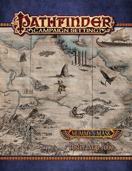
Announced for July! Cover image is a mockup and subject to change.
| Jurgen Dark |

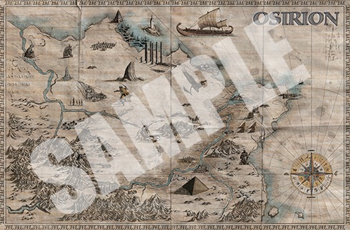
Is the map by Ben Wootten the same as the centerfold from People of the Sands?
If so this will the continuation of a fantastic trend. I am really happy with these maps.
|
|

Is the map by Ben Wootten the same as the centerfold from People of the Sands?
If so this will the continuation of a fantastic trend. I am really happy with these maps.
Yep! It's the same one in the center spread of People of the Sands.
I love Ben's maps.
 Rysky
Rysky
|

Jurgen Dark wrote:Is the map by Ben Wootten the same as the centerfold from People of the Sands?
If so this will the continuation of a fantastic trend. I am really happy with these maps.
Yep! It's the same one in the center spread of People of the Sands.
I love Ben's maps.
Now just waiting his Numeria maps :3
| Fayries |

For some reason, I don't see this item appearing on the Pathfinder Campaign Setting listing.
| Liz Courts Webstore Gninja Minion |
For some reason, I don't see this item appearing on the Pathfinder Campaign Setting listing.
Fixed!
| Majuba |

Jurgen Dark wrote:Is the map by Ben Wootten the same as the centerfold from People of the Sands?
If so this will the continuation of a fantastic trend. I am really happy with these maps.
Yep! It's the same one in the center spread of People of the Sands.
I love Ben's maps.
Just what I wanted to hear - awesome! {Both a full country map, and Ben doing it}
| Heine Stick |

I wish I could opt out of this one for my subscription. No real desire to buy this one. :-(
You can in the sense that you can unsubscribe and then resubscribe when the next book in the Pathfinder Campaign Setting line comes around. :)
 Noven
Noven
|

Noven wrote:I wish I could opt out of this one for my subscription. No real desire to buy this one. :-(You can in the sense that you can unsubscribe and then resubscribe when the next book in the Pathfinder Campaign Setting line comes around. :)
Huh, good call on that. Never really considered that. This just seems like a weird product to be on the campaign setting sub instead of the AP sub.
| OldManJim |

Yeah, I wish this was part of the AP sub itself.
It feels kind of wrong to subscribe just to get a single PDF for free.
But if it saves me $14...
 logic_poet
|

Heine Stick wrote:Huh, good call on that. Never really considered that. This just seems like a weird product to be on the campaign setting sub instead of the AP sub.Noven wrote:I wish I could opt out of this one for my subscription. No real desire to buy this one. :-(You can in the sense that you can unsubscribe and then resubscribe when the next book in the Pathfinder Campaign Setting line comes around. :)
Back in the day, the map pack compiled the AP maps, but since Kingmaker, they've compiled more generally useful maps (often two cities the party visits over the course of the AP), so they're now more campaign setting oriented. For instance, Jade Regent had maps of Tian Xia, The Crown of the World, and Kasai.
| M0u53b41t |

These are beautiful, artistically. I am wondering what they're made out of? I should find out soon as I ordered the folio but in the mean time I'm curious :) Anyone also know how well they last? ie - are they pretty tough or do we need to be fairly gentle with them?

|
|

Just wanted to mention that I love the player-facing maps like in this one and Shattered Star. They make those folios a snap purchase whenever I run a campaign in that country (even if it's not the AP they're intended for).
Cheers!
Landon
 Jan Schattling
|

I just got my copy and the maps are really good looking.
Anybody a good idea how to age the backside so it is more looking like the front?
I would prefer more of an ingame look and feel.
|
Ayanzo
|

Would have been nice if there was an option to turn off the tags in the PDF version. I usually like to hide specific locations on the maps for players to discover. I'll make do with some image manipulating software, but I'd prefer if I didn't have to.
|
Jan Schattling
|
Ayanzo has a point there that is also true for the paper maps.
I think I would like them more and they would be better to use in game without the marks and annotations.
That way the players would not be influenced by the numbers on the map and get no information they should not have.
Is there a reason why it is that way?
 Robert G. McCreary
Senior Developer
Robert G. McCreary
Senior Developer
|
| 1 person marked this as a favorite. |

We try to make the maps in the Map Folios with the most utility for the most people. In our minds, that means we put tags on most of the maps (and indeed, we have received very strong feedback that people prefer tagged maps to untagged maps), but these tags are gazetteer tags, not adventure locations. So the Wati map includes tags for locations in the Wati gazetteer in Pathfinder 79 (locations that most people would know about), but doesn't have tags for any of the adventure locations in Pathfinder 79 or 80. Likewise, the Tephu map includes tags for well-known locations, but not adventure locations like the various sites of the Great Library of Tephu.
The map of Osirion, however, was specifically desgined as a player map. It is more "artistic," representing a map that could be found on Golarion, and contains no tags. Compare it to the map in Pathfinder Player Companion: People of the Sands - it's the exact same map, but the version in the Player Companion has tags, to make it more useful with the book (and with Osirion, Legacy of Pharaohs Campaign Setting book), while the poster map version has no tags, making it useful as a physical player handout.
|
Jan Schattling
|
I guess I should have checked the tags before I wrote.
Being points of local interest, these tags are completely ok for me.
I was just irritated because of the ones in the Necropolis.
The Osirion Map is pretty cool and with some dark ink smeared on the back to acommodate the front I will hand them out to my players at the start of the campaign. :)