


 Dark_Mistress
|

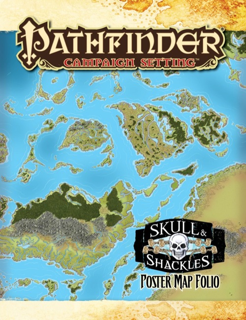
So what exactly are the maps of? It would be cool if the treasure map from the 2nd book is in here though, as a player handout.
| Kain Darkwind |

Ah, Map Folios, proof that the ease of subscribing is worth the pain of a few non-used elements every year.
How do you know what's in the second book, Dark Mistress?

| Are |

I'm guessing it's an error that both paragraphs of the product description say the same thing. Should the second paragraph have specified which areas the maps depict?
All of the map folios since Kingmaker have been awesome, so this will surely be, too :)
| Liz Courts Contributor |

I'm guessing it's an error that both paragraphs of the product description say the same thing. Should the second paragraph have specified which areas the maps depict?
Removed the extraneous paragraph, and when I get an updated product description (which probably won't be for a while yet), it will get posted.
| Macharius |

How do you know what's in the second book
It's part of the product description. :)
When they discover a treasure map tattooed on a defeated pirate rival
|
|
The product description has been updated. (It will likely change again prior to publication, but it's now more informative.)
| Are |
and the entire Shackles Isles region!
Awesome! That's exactly what I hoped would be in this one :)
I some times wonder if the Paizo team have hired a mindreader..
| Kain Darkwind |
Kain Darkwind wrote:How do you know what's in the second bookIt's part of the product description. :)
Raiders of the Fever Sea (2 of 6) wrote:When they discover a treasure map tattooed on a defeated pirate rival
...yeah. So Dark Mistress isn't omniscient. I just can't read. My bad.

 logic_poet
|
| 1 person marked this as a favorite. |

Ah, Map Folios, proof that the ease of subscribing is worth the pain of a few non-used elements every year.
...
To be fair, now that Paizo moved away from compiling the dungeon maps in the associated AP and switched over to making big versions of more generic areas, the Map Folios have gotten more useful.
For example, the Carrion Crown Map Folio is handy for any campaign set in Ustalav.
| Michael Martinez-Colon |

Well...I hope this map folio shows mayor wind pattern directions and surface ocean currents...
|
|

Wind and ocean patterns and currents would be cool... but since we don't have any meteorologists on staff to ensure we did it right, it's not something I'm eager to try.
 uriel222
|

Wind and ocean patterns and currents would be cool... but since we don't have any meteorologists on staff to ensure we did it right, it's not something I'm eager to try.
Did you ever consider cloudsourcing?
| Wolf Munroe |

Kain Darkwind wrote:Ah, Map Folios, proof that the ease of subscribing is worth the pain of a few non-used elements every year.
...To be fair, now that Paizo moved away from compiling the dungeon maps in the associated AP and switched over to making big versions of more generic areas, the Map Folios have gotten more useful.
For example, the Carrion Crown Map Folio is handy for any campaign set in Ustalav.
I have the map of Ustalav from the Carrion Crown Map Folio framed in a poster frame, just haven't decided where to hang it. Still wish it had Sen's Pass on it, but other than that oversight, I love it. I've considered buying a second copy.
I care less about the other map folios since I care less about their regions, but I do think the map folio line has significantly improved since it launched.
| Michael Martinez-Colon |
Wind and ocean patterns and currents would be cool... but since we don't have any meteorologists on staff to ensure we did it right, it's not something I'm eager to try.
Hi James, I am an Oceanographer and determining wind directions and surface ocean currents in a map is not that difficult. I got a world map of Golarion and after I added latitude/longitude the Shackles is about 20 degrees North of the equator dominated by NE tradewinds. I made the assumption that the tilt of the planet is the same as the Earth's and that the planet rotates on its axis once every 24hrs and has the same orbit shape around its sun as Earth. Which I do not know if it is the same for Golarion.
I am more than willing to provide help if you want. I can email you the map so you can see it but do not know how to send attachments in this forum.
| Mr. Quick |

I almost don't want to start skull and shackles without this map folio. I'm running kingmaker and if I didn't have the maps it would be VERY difficult to run the campaign.
| MJinthePitt |

I almost don't want to start skull and shackles without this map folio. I'm running kingmaker and if I didn't have the maps it would be VERY difficult to run the campaign.
I've alerted my group that we'll be taking a break in September from my current "Zombies on the Borderland" homebrew to run the entire Skull & Shackles AP once all of the books and pawns are released. I'm really looking forward to getting my hands on everything and taking the entire summer to get familiar and prep!

| Ravien |

Yea a picture of at least a corner of the player handout map would be nice. So I could know if it is worth buying the physical product or if the PDF will be enough as we play using a virtual table top. ;)
| Rob Duncan |

I was hoping for posters of all the maps for all the modules themselves (like flip-mats). It isn't that. It /is/ pretty cool for fleshing out areas and building in some "side trips".
| Steve Geddes |

I really like the player handout, although it does reduce the utility of the other poster map of the shackles. (poster maps I'm not going to show players aren't terribly valuable to me).
| gbonehead Owner - House of Books and Games LLC |

Am I missing something?
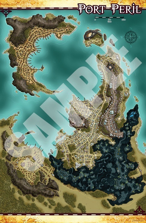
I had expected the GM's map of The Shackles to be a poster-size version of the map they added to the Isles of the Shackles page as a free download. Is there something I need to turn on to get the labels to show? Or are they just not there?
If this folio really does include what is essentially two copies of the same map, that's a bit disappointing, especially since there's only three maps in it.
 Dragnmoon
|

If this folio really does include what is essentially two copies of the same map, that's a bit disappointing, especially since there's only three maps in it.
I was hoping for the same and was disapointed for the same reason
| Liz Courts Contributor |
Product description says:
Within this map folio, you’ll find three huge 8-panel poster maps: one of the pirate city of Port Peril, another depicting the hundreds of isles comprising the Shackles, and a giant player handout designed to look like an ink-and-parchment nautical map of the region—complete with sketches of local threats and infamous buccaneer legends!
So you get:
- One unlabeled map of Port Peril
- One unlabeled map of The Shackles
- One ink-and-parchment-styled map of the Shackles (great for treasure maps and the like)
|
Dark_Mistress
|
Yeah i liked the ink and parchment styled map. It was very cool, wish we could get the same for every region a AP covers.
| Fitzwalrus |

Am I missing something?
I had expected the GM's map of The Shackles to be a poster-size version of the map they added to the Isles of the Shackles page as a free download. Is there something I need to turn on to get the labels to show? Or are they just not there?
If this folio really does include what is essentially two copies of the same map, that's a bit disappointing, especially since there's only three maps in it.
I had the same reaction. Given the excellent information available in the PDF it makes no sense that what should be the GM's campaign map in this folio is unlabeled. Had I realized that going in I would have saved my money - the Port Peril map is nice but is duplicated in Tempest Rising, and the "parchment" handout map for the PCs is a nice touch but not as useful without the master map information to go along with it.
Given the anticipation this product generated I think Paizo seriously missed the boat on this one. I shall be very careful to see exactly what's in future offerings before putting down any money after this....
| zagnabbit |

I won't say I was disappointed by this product, because I got exactly what was offered.
Sadly this line of products need something.
Poster sized maps of cities that are unkeyed are not much more useful than a full page map in the AP. They're pretty but I'd almost rather get a poster of a cover artwork. Along the same train of thought, poster maps of the region are nice but not nearly as useful as they could be. The lack of names for geographic features, even colloquial names, is disappointing. We have plenty of maps of the region, if these maps are more detailed than the macro that's fantastic but the level of improvement would seem to be key.
The faux parchment map is a nice addition, it's a functional, works as a player hand out and even fits with an item in the 3rd episode. More like this would be nice.
I'm not sure of the logistics of this product but for this AP, a battlemap of the ship would have been a far more useful inclusion. I know that there is a desire to keep the battlemaps separate but the maps offered so far in this line are of middling use. That makes this, for me, a vanity purchase. My resources would have been better spent on something else.
So far, only Kingmaker has proved to be an indispensable accessory to an AP line. One that will inevitably require me to repurchase the product. The fact that only once has this proven true is an issue that needs to be addressed. I have the distinct feeling that if not for subscriptions this would be a very short lived line.
Good Luck, this is a vastly improved line from the RotRL map pack but it needs an innovation if I'm to continue it's support.
| Kantrip |

I bought it expecting the same detailed map as in the free download and was very disappointed to find an unlabeled map. Are my players supposed to write on it as they explore? I don't see that happening. So what use it it other than it looks good? It looks like I'll have to print out section by section the downloadable, labeled map, just for my use as I run it.
The hand out "hand drawn" map is great and I can see using that.
I'm considering putting the town map and unlabeled map under a sheet of clear plastic, so the players can write on it with grease pencils, but that won't be nearly as useful as a labeled map would have been.
| Feros |
| 1 person marked this as a favorite. |

I have noticed something rather odd: there seems to be no way to get from Merchant Marina to High Eastwind. In fact, there seem to be no roads connecting High Eastwind to anywhere, even through the Knotworks! How do the wealthy of Port Peril get to and from their homes high above the rest of the city?
| Liz Courts Contributor |
Hmm...I know in the original map turnover that I received, there was a wide road that went from Merchant Marina to High Eastwind. However, that seems to vanished, but it looks like another route is available through the Knotworks. Also, Zeru Faizel (of Latchmin's Folly) would likely have some sort of lift system that she charges outrageous prices for to move people and goods up to High Eastwind.
| Jim Cavalcoli |
James Jacobs wrote:Wind and ocean patterns and currents would be cool... but since we don't have any meteorologists on staff to ensure we did it right, it's not something I'm eager to try.Hi James, I am an Oceanographer and determining wind directions and surface ocean currents in a map is not that difficult. I got a world map of Golarion and after I added latitude/longitude the Shackles is about 20 degrees North of the equator dominated by NE tradewinds. I made the assumption that the tilt of the planet is the same as the Earth's and that the planet rotates on its axis once every 24hrs and has the same orbit shape around its sun as Earth. Which I do not know if it is the same for Golarion.
I am more than willing to provide help if you want. I can email you the map so you can see it but do not know how to send attachments in this forum.
Michael, I'm just starting my Skull & Shackles adventure and I would love to get a copy of the winds / currents maps of Golarion that you made. That would be a great addition. I'm trying to have weather, currents and winds be a bigger part of sailing around the adventure.
Thanks !
Jim
| Koor |

What are the dimensions of these maps? It's unfortunate that the only dimensions I'm seeing anywhere are the 8.5 x 11 size of the folded maps.
| gbonehead Owner - House of Books and Games LLC |
I *believe* they're 3x3 sheets. The PDF lists the size as 21.75" x 33.2" which is an odd size.
Note: the back of the map folio says "Within this map folio, you’ll find three huge 8-panel poster maps," which means they'll each be 22"x34". That does sound about right - 4x8.5" by 2x11"
| Liz Courts Webstore Gninja Minion |
The maps are 8 panels—2 panels wide by 4 panels long, and I believe they are 22 by 34 inches.