Andrew Tuttle |
Wow.
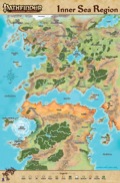
I wasn't sure I wanted to pull out the map from my copy of the Inner Sea World Guide.
Now, I know I won't. I'll order this!
Thanks, Paizo!
-- Andy
Liz Courts Contributor |
Lisa Stevens CEO |
Heading for the West, Heading for the EastOur Price: $9.99 Add to CartThe new Inner Sea World Guide Map is now available separately!It’s been a wild four years since we introduced the country of Varisia in our very first Paizo blog. Since then, we've revealed that it's just a small portion of the northern continent of Avistan in the Inner Sea region of Golarion. Over the course of more than 40 Adventure Path volumes, plus a host of Modules, Player Companions, and Campaign Setting books, we've revealed much, much more than we first hinted at all those years ago. And now cartographer Rob Lazzaretti has masterfully crafted and updated the map of the Inner Sea Region that evolved from the initial sketches created by Erik Mona and his Merry Men. Initially available with the Inner Sea World Guide, this map is now available separately. The eight-panel, 21.75-inch by 33-inch map covers all of the countries of Avistan and northern Garund, from the Lands of the Linnorm Kings in the northwest to the Vudran outpost of Jalmeray in the southeast, with capitals and major locations labeled, as well as prominent forests, mountains, and rivers. If that's just not big enough for you, you'll want to get your hands on the Inner Sea Poster Map Folio. It's four times larger—nearly 20 square feet of adventure goodness—and includes tags for just about every Inner Sea location we've ever mentioned anywhere. This is the largest map we've published to date—and even it shows just one region of Golarion! Maybe someday we’ll make it out of the Inner Sea to Arcadia, Casmaron, or even Sarusan, but until then, head down to the docks of Absalom, get a tall ship and find a star to steer her by—I hear there's something afoot in Jalmeray!
Recent threads in General Discussion
|